The CSIRO will develop a world-first ground to space water quality monitoring system with dozens of government, industry and research collaborators under its next science mission.
The mission – the latest in a handful of the CSIRO’s large scale scientific and collaborative research initiatives – will use Australian made ground and satellite sensors and big data to create a multi-day forecast of water quality at waterways around the country.
The project, known as AquaWatch, was announced on Wednesday, with the SmartSat CRC named as a foundational partner and a total co-investment of $83 million.
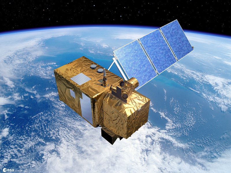
CSIRO researchers and collaborators will use a network of earth observation satellites and ground-based water sensors to collect data that the CSIRO will centralise and apply artificial intelligence to for water quality forecasts days in advance.
AquaWatch is launching on World Water Day and just days after another mass fish kill in an Australian waterway.
The mission will support better water quality management, with early warning of harmful events such as toxic algal blooms, blackwater and runoff contamination .
The data from the CSIRO mission – which is expected to run until at least 2030 – will be useful for managing water environments, including levels in rivers, or identifying and catching plastic waste before it reaches the ocean.
There’s also a potential application to improve water use in industry. For example, a desalination plant aware of high levels of algae could avoid using it and the expensive and time consuming clean up process it would cause due to the membranes used in the process.
A long term possibility is to integrate AquaWatch in water safety monitoring around the world. The UN has warned water kills more people than war, while 3 billion people are relying on water that has an unknown quality.
While Australia generally has very high water quality, the environment is under unprecedented pressure.
“The impacts of climate change, increased pressures on coastal environments, increased, agricultural activities and use pressure inland is really changing the conditions of water in all of those areas,” AquaWatch deputy lead Dr Neil Sims said.
Dr Sims said the increased severity of extreme weather caused by climate change is having an impact of the usability of water.
“When we get really dry times, for example, and the rivers stop flowing and they warm up a bit, then you get things like the world’s longest algal bloom in the Darling river,” he told InnovationAus.com.
“And then when there’s a long period of drought and then a flood comes through, you can get things like these fish kills.”
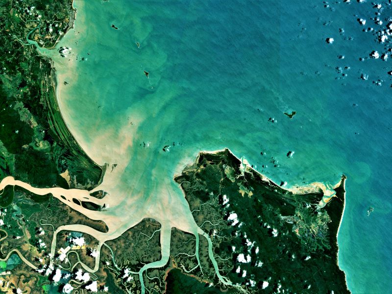
AquaWatch trials have already occurred at six pilot sites during its time as a mission in development, but the funding and full fledged Mission status will see this expanded to more rivers and coasts, with the ability to monitor bays, coastal wetlands, aquaculture farming, mangrove forests and coral reefs.
Additional pilots established overseas will demonstrate how AquaWatch can monitor water quality for drinking, sanitation, species conservation, hydroelectricity and carbon sequestration in mangrove forests.
The CSIRO will be relying on existing satellite imagery for the early phases and will do so until new sensors are launched.
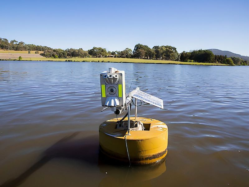
The foundational water and satellite sensors as well as the data platform are all being designed and built in Australia.
The sensors in both the water and space measure the colour of the water in multiple different wavelengths to interpret the content of the water. A CSIRO developed data analytics platform is being built to ingest the huge amounts of data AquaWatch will generate.
“Linking the measurements from the water into the space means that we can get a really good calibration of our data from the small area that the on-water sensors are looking at to the much larger area that the satellites let us get a measurement of.
“So we can extrapolate very accurately from those local points right across a much larger extent of water.”
The data flows into the CSIRO’s AcuraWatch Data Integration and Analytics System, an advanced data processing, storage forecasting and modelling tool.
“It’s scalable enough so that we can add many, many sites to this over time. There’s going to be a whole lot of data coming in from lots of sites all over the world and we built a system again that can handle all of that data and include all of these great models that we’re getting CSIRO people and our partners across Australia and internationally to build for us,” Dr Sims said.
Do you know more? Contact James Riley via Email.